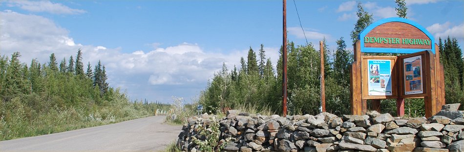
The Dempster Highway, Yukon and Northwest Territories Canada - Summer 2008
ALL Photos © K. Dewey, School of Natural Resources, Applied Climate Sciences, UNL.
Northbound, July 5-6, 2008; Southbound, July 8-9, 2008
| Northbound Photo Gallery One |
| Northbound Photo Gallery Two |
| Northbound Photo Gallery Three |
| Southbound Photo Gallery Four |
| Southbound Photo Gallery Five |
From Wikipedia, the free encyclopediaFrom Wikipedia, the free encyclopediaThe Dempster Highway
Richardson Mountains. The Dempster Highway, also referred to as Yukon Highway 5 and Northwest Territories Highway 8, is a highway that connects the Klondike Highway in the Yukon Territory of Canada to Inuvik, Northwest Territories on the Mackenzie River delta . During the winter months, the highway extends another 194 km (121 mi) to Tuktoyaktuk, on the northern coast of Canada, using frozen portions of the Mackenzie River delta as an ice road. The highway crosses the Peel River and the Mackenzie Rivers using a combination of seasonal ferry service and ice bridges. The highway begins about 40 km (25 mi) east of Dawson City, Yukon on the Klondike Highway and extends 736 km (457 mi) to Inuvik. HistoryIn 1958 the Canadian government made the historic decision to build a 671 km (417 mi) road through the Arctic wilderness from Dawson City to Inuvik. Oil and gas exploration was booming in the Mackenzie Delta and the town of Inuvik was under construction. The road was billed as the first-ever overland supply link to southern Canada, where business and political circles buzzed with talk of an oil pipeline that would run parallel to the road. The two would ultimately connect with another proposed pipeline along the Alaska Highway. On 17 August 1959, Ottawa announced that oil had been discovered in the territory’s Eagle Plains and, almost immediately, the government gave major concessions to the oil industry in an attempt to stimulate more exploration in the area. It was realized that a highway across the Arctic Circle would be needed to transport equipment, infrastructure and revenue to and from the sites. Consequently, construction began at Dawson City in January 1959. However, the highway's high costs, in addition to ongoing wrangling between the federal and Yukon governments kept progress at a snail’s pace until 1961, when building stopped altogether. Only 115 km (72 mi) of roadbed had been built before the project was abandoned. There were no more developments until 1968, when a discovery of huge reserves of oil and gas at Prudhoe Bay, Alaska was made. Final ConstructionThe Dempster Highway - Canada’s first all-weather road to cross the Arctic Circle - was officially opened on August 18, 1979 at Flat Creek, Yukon. It was unveiled as a two-lane, gravel-surfaced, all-weather highway. Ferries handle the traffic at the Peel River crossing near Fort McPherson and the Arctic Red River crossing near Tsiigehtchic. The design of the highway is unique, primarily due to the intense physical conditions it is put through. The highway itself sits on top of a gravel berm to insulate the permafrost in the soil underneath. The thickness of the gravel pad ranges from 1.2 m (4 ft) up to 2.4 m (8 ft) in some places. Without the pad, the permafrost would melt and the road would sink into the ground. In addition to services in Fort McPherson, Tsiigehtchic and Inuvik, there is one location with commercial services along the highway, at Eagle Plains. It is an important fuel and food stop because of the great distance, and harbors stranded travelers when the highway is closed due to extreme weather conditions. (Until 1979, the highway was only open in summer.) During the early 1990s, Northwestel erected microwave towers along the highway to facilitate public safety with manual mobile telephone service and to provide government agencies such as highway maintenance and the RCMP with communications. The microwave project was opposed by some environmental interests and those who preferred the pristine appearance of the route. A suggestion to install fiber optics would not have enabled mobile communications. Since then, the route has become the terrestrial link to the exchanges in the Mackenzie Delta region. |
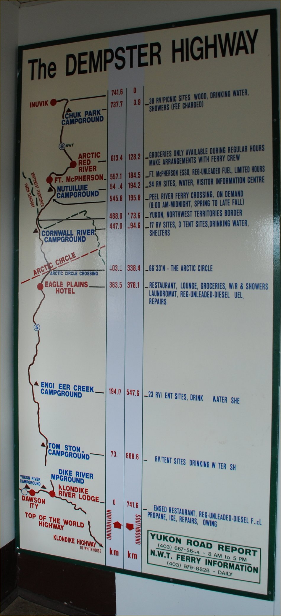 Click HERE on or the above photo to see a very large and readable version of this map that I photographed at Eagle Plains, Yukon hotel on the Dempster Highway. |