June 13, 2001
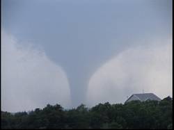
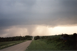
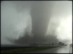
Tornado Producing Thunderstorms in Southeast Nebraska.
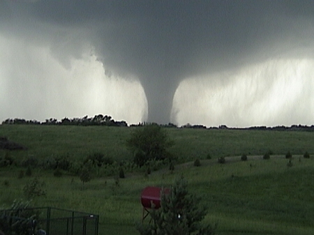
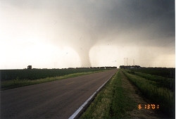

F-4 Tornado east of Seward, Nebraska, June 13, 2001
Above Photo © Sherry Reinert.  CLICK HERE for more of Sherry's Photos

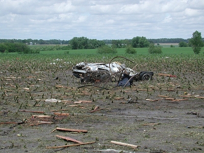
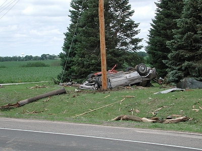
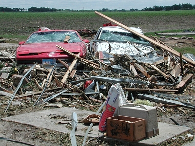
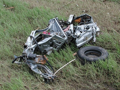
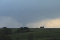
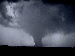
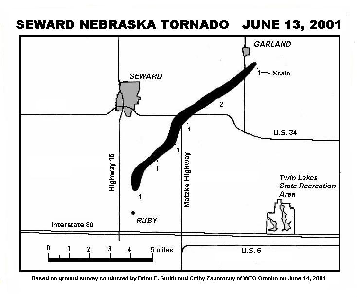
June 13, 2001 Tornado PHOTO GALLERIES
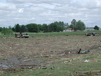
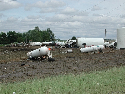
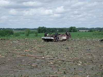
Seward Nebraska, June 13, 2001 - Tornado Damage Photographs
(courtesy of Brian Smith, Cathy Zapotocny, Omaha NWS)

Click on the links to go to these photo galleries


NEVIT Member Brian Thalken
Seward, NE, Tornado.

NEVIT Member Brian Thalken &
Jason Ehmke 35 mm Photos
Seward, NE tornado.

NEVIT Member Jeremy Wesely
Seward, NE tornado.

UNL Met. Student Matt Sherman
Seward, NE tornado.

Tim Marshall, Storm Track Magazine
The Narka tornado just south at the Nebraska border.

Jeff Piotrowski, Storm Productions, Inc.  Seward, NE Tornado.
   

Damage map courtesy of Brian Smith, WCM, Omaha/Valley NWS
The numbers on the map refer to the "F-Scale" rating based upon observed damage.

June 13, 2001 Weather Data
(maps, radar, satellite, photos, etc.)

NOAA Satellite Image
No. Plains Satellite Images
So. Plains Satellite Images
Radar Loops
Complete list of Tornado Warnings
June 13 Storm Report List & Map
.Damage Survey
SPC June 13, 2001 Forecasts


12 Hour ETA Forecast Lincoln, NE Surface Charts, Midwest, June 13
Temperature Maps Andrew Revering, S.D. Tornadoes

News Reports

Storms Hit Seward County Tornadoes Smack State
Tornadoes Roll Across State Tornadoes Sighted Across State
Tornadoes Touch Down in E. Neb. Seward Tornado
Tornadoes Hit Seward County
Family Loses Home but Escapes Injury

This is a view of the tornado producing thunderstorm from 20 miles east in the city of Lincoln, at the time of the Seward tornado.  The main updraft can be seen in the lower right, mammatocumulus have begun to form on the anvil and another cell has begun to form off to the southwest.


This is what occurred on this day.
Click here to see what was forecast!

Map of yesterday's severe weather reports

Return to: The Photo Gallery Index Page