
Photo© High Plains Regional Climate Center. |
 |
|
photo to see a large version. |
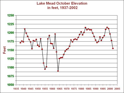
graph to see a larger version |
|
Photo© High Plains Regional Climate Center. |
|
|
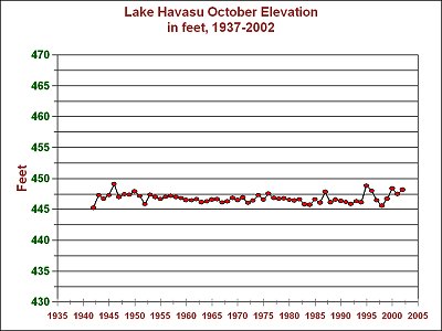
photo to see a large version. |
graph to see a larger version |
A two story sightseeing boat on
Lake Mead (in the above photo) is dwarfed by the white ring
around the lake. The white
ring is rock area exposed due to the dropped level of the lake.
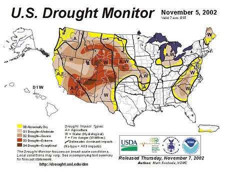
Click
HERE
or on the map to see it full size.
Portions of the
Southwest are in a Category D4 "Exceptional Drought"
CLICK
HERE to see the other Drought Monitor Maps from this year
see a larger version |
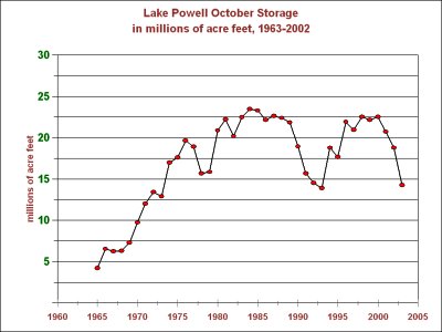
Click HERE or on the graph to see a larger version |
|
|
IMPORTANT LINKS:
Western Regional Climate Center
High Plains Regional Climate Center