Satellite Image of Nebraska
Showing snow cover
Analysis of the image is found below the image.
Image is a GOES East CONUS satellite image provided by NASA.
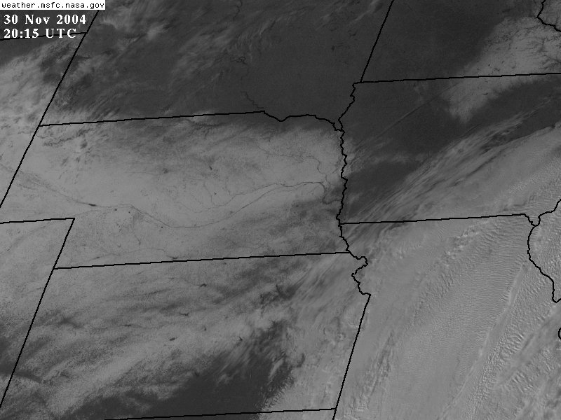
Analysis:
| Nebraska is snow covered except for the a small area bordering the South Dakota border from Sioux City back west about 200 miles. Southeastern Nebraska has a thinner snow cover so is a mixture of gray and white. The darker gray areas of Lincoln and Omaha show the fact that urban areas lose their snow cover more quickly than rural areas. Individual lakes are easily visible in Kansas and Nebraska. Lake McConaughy is visible in western Nebraska and is only about 1/3 the size that would be expected if it were full. The dark meandering line of the Platte River is very evident in the image as well. Some clouds on the western edge of the major storm system are in far southeastern Nebraska and the eastern 100 miles of Kansas. The swirl of the clouds in the departing storm system are evident in Missouri and southeastern Iowa. Another small snow covered area stretches from north central Iowa into Minnesota. |