Storm Chase,
Lincoln, NE to Dodge City,KS
All Images © Ken Dewey, School of Natural Resources, UNL.
What appeared
at first to just be another typical Spring day in the Great Plains with
small puffy
cumulus clouds was in fact a moderate risk for strong convection and supercell
thunderstorms.
The major
ingredients seemed to be present for an outbreak of tornadoes. There
were high CAPE values, strong
deep shear,
a dryline and an upper level disturbance approaching from the southwest.
We anticipated initiation of supercells to
take place
in far southwestern Kansas late in the day and headed in that direction
at 8:30 AM.
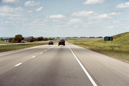
We traveled
west to York, NE, south to Salina, KS,
and then
southwest across Kansas, to Dodge City for a
briefing
at the NWS office. Partly cloudy skies, temperatures
in the
90's with 70 degree dew points made the day very oppressive.
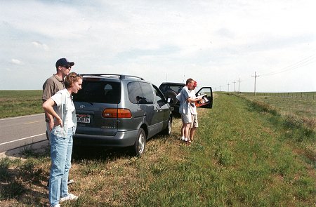
We drove
south to near the Oklahoma line
and waited
for the cap to break.
Finally,
a cumulus cloud began to rapidly mushroom upward
off toward
Liberal, KS at the Oklahoma border. Examining the road maps,
we knew
the large distance between roads out here would be a problem.
On the
positive side, as we headed for the backside of the supercell,
there was
literally nothing to block the view for miles and miles.
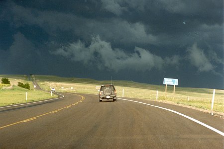
We positioned
ourselves on the west side of the supercell
in Plaines,
KS, as it moved east southeast at 35 mph.
Finally,
a small funnel began to form, but it quickly lifted.
Noting
the strong rotation in the wall cloud,
we knew
it was likely to drop another tornado, so we
began to
pursue the storm once again.
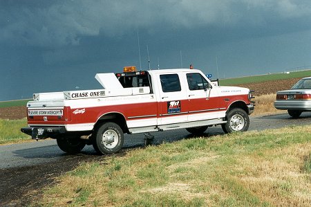
Parked
nearby was a chase vehicle that would give any chaser
"vehicle
envy"!
Dodge City,
KS issued a warning for a possible tornado
southeast
of Meade, KS based upon Doppler radar.
The next
paved road to the south was over 30 miles away so we
decided
to cut across the region on a gravel road.
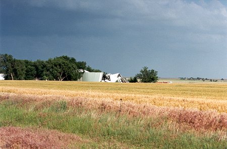
As we neared
Meade State Park the NWS office in Dodge City, KS
issued
a statement on weather radio that a small tornado had just
exited
the state park. We saw the fresh damage to some
storage
buildings and knew we were close.
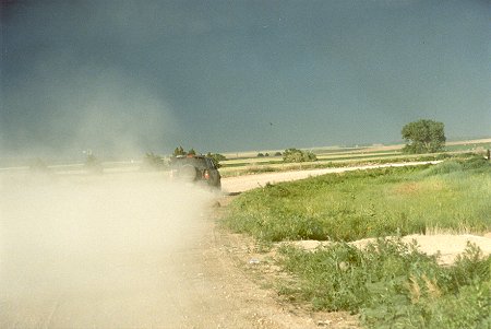
The gravel
road we were on dead ended on a north-south road.
We had
to make a choice of going back north or heading south. With the speed
of the
storm, the shorter distance to the northern paved road seemed
more appealing.
We headed 14 miles north and then drove toward Ashland, KS
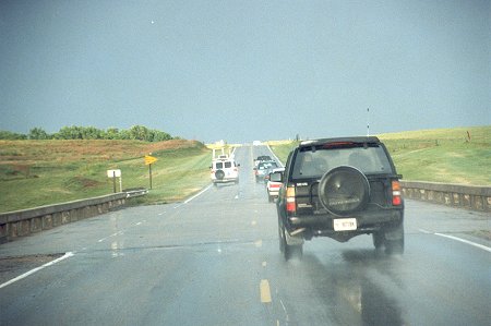
Just outside
Ashland, KS we joined up with a convoy of chasers,
including
several VORTEX vehicles and the VORTEX command
vehicle with project leader Erik
Rasmussen (seen passing
part of the convoy, ahead on
the left).
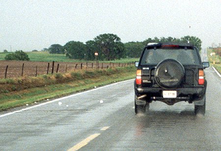
Monitoring
the scanner, we learned that both VORTEX and Howie Bluestein
were reporting
baseball size hail a half mile ahead of us. As we
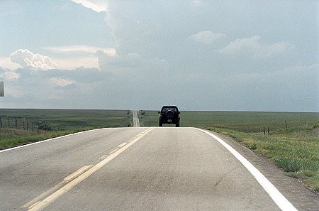
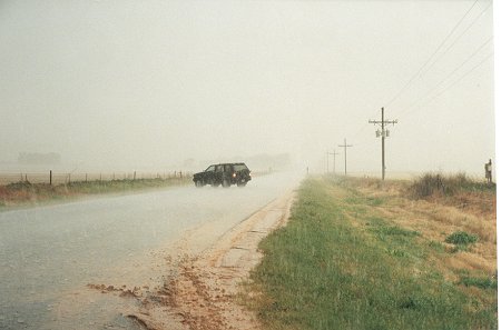
entered
the area, large hail (note the road to the left of the
SUV below)
was observed on the road. WE STOPPED.
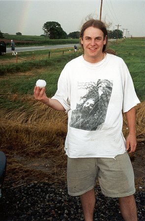
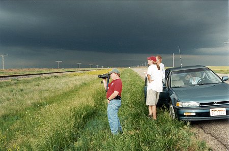
And, along with other chasers
not wanting to get hail damage,
we stopped and took pictures
of the large hail.
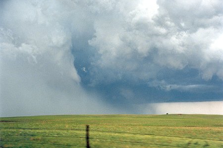
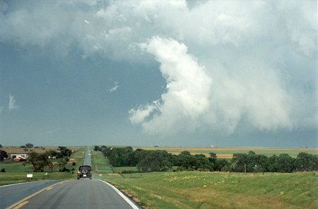
We re-joined
the chase, but were repeatedly beaten back by
the heavy
rain and hail. The best we were able to see was the
outline
of the tornado through the rain shield.
At this
point the storm had entered the most open area of the state
and we
were over 35 miles away by road yet only 5 miles from the tornado.
The few
that were successful on this day, chose the southern
route and
approached the supercell from the rain-free side of the storm.
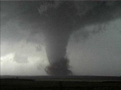
Click on
the tornado photograph just below to see the photos
taken by
Bob Conzemius & Shaun Kelly who managed to get to
the southern
side of this supercell.
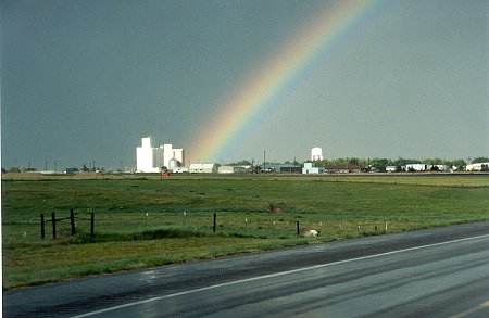
As we drove
north back toward Nebraska. We were still pleased with the chase,
despite
not getting a good view of the tornado. The students on the chase
know that
it is not
exclusively the observation of tornadoes, but it also includes an
understanding
and observation of the entire storm process. Just outside
of Protection,
KS we were greeted by a rainbow.
Return to: The Photo Gallery Index Page