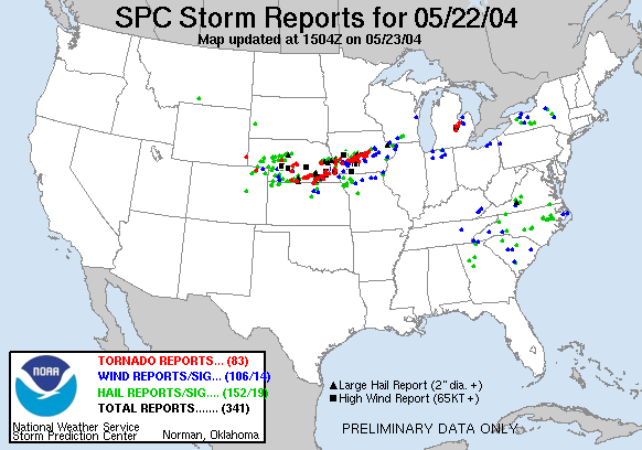
May 22, 2004
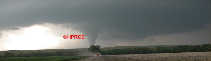
Image © Ken Dewey, Applied Climate Sciences, School of Natural Resources, UNL
UNL Nebraska
Vortex Intercept Team Photographs tornadoes and
violent
storms as they cross the state on Saturday, May 22, 2004
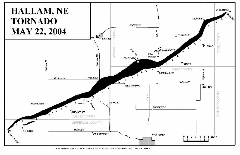
Click
here to see the full size map of the Hallam, NE tornado.
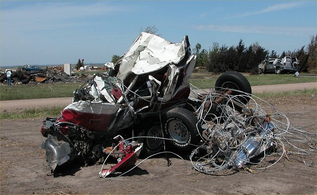
Image ©
Ken Dewey, Applied Climate Sciences, School of Natural Resources, UNL.
The above is an extended cab pickup truck after encountering the tornado last Saturday.
Tornado
and Storm Photos May 22, 2004
Storm
Photo Gallery 1
May 22, 2004 Tornado: Tornado Damage Photos