All Images © K. Dewey, School of Natural Resources, UNL.
Note that the snowstorm only
affected eastern Nebraska with 7 inches of snow in Lincoln and 12 inches
in Omaha, Nebraska.
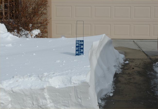
Snowfall Depth in Southeast Lincoln
All Images © K. Dewey, School of Natural Resources, UNL.
Note that the snowstorm only
affected eastern Nebraska with 7 inches of snow in Lincoln and 12 inches
in Omaha, Nebraska.
Snowfall Depth in Southeast Lincoln
|
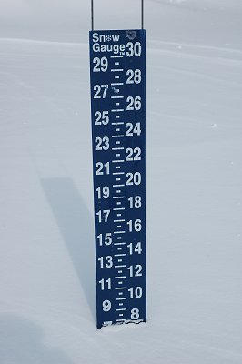
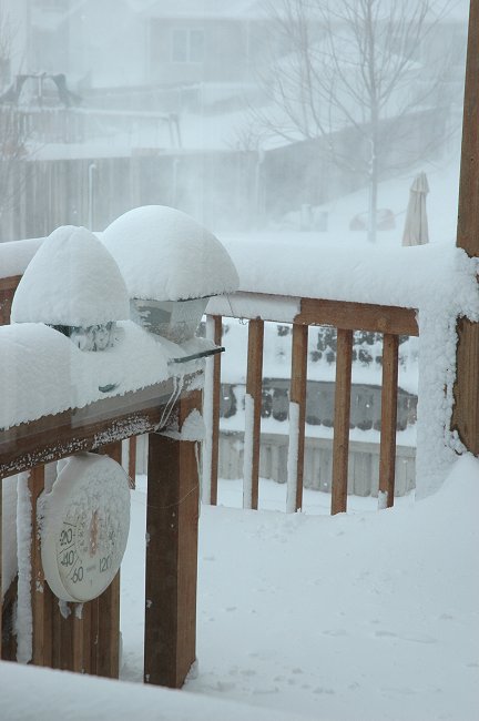
7.5 inches of snow in non-drifted areas |
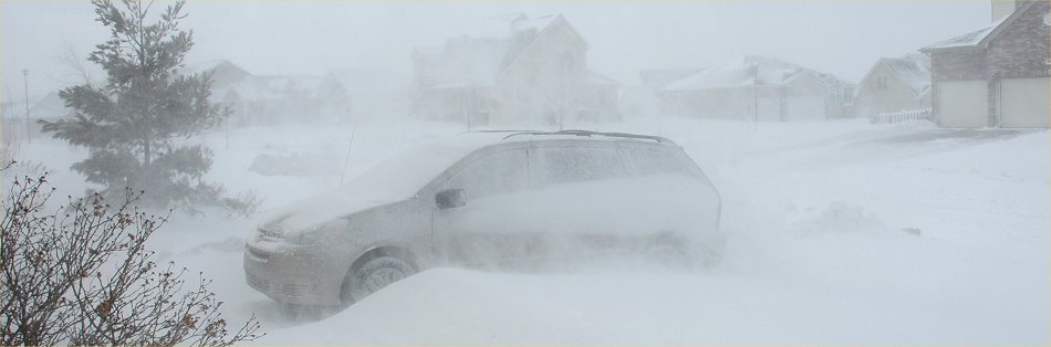
Near white-out conditions at
the height of the storm
At the height of the storm
At the height of the storm

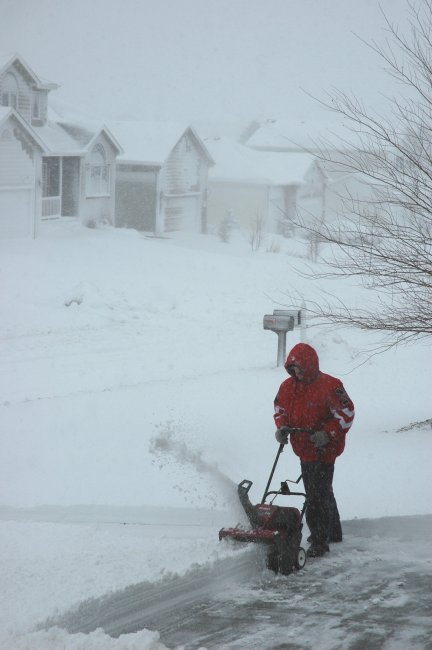
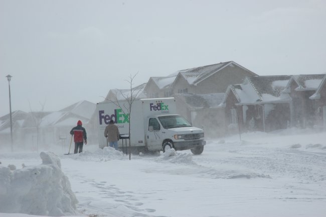
Clearing the snow from a
driveway in Lincoln
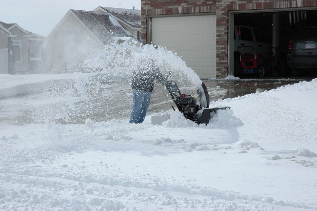
Clearing the snow from a
driveway in Lincoln
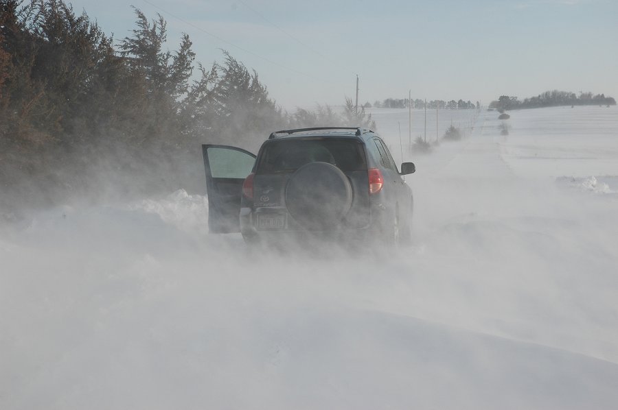
Rural roads were in awful
condition with blizzard conditions
A rural Lancaster County road
A rural Lancaster County road
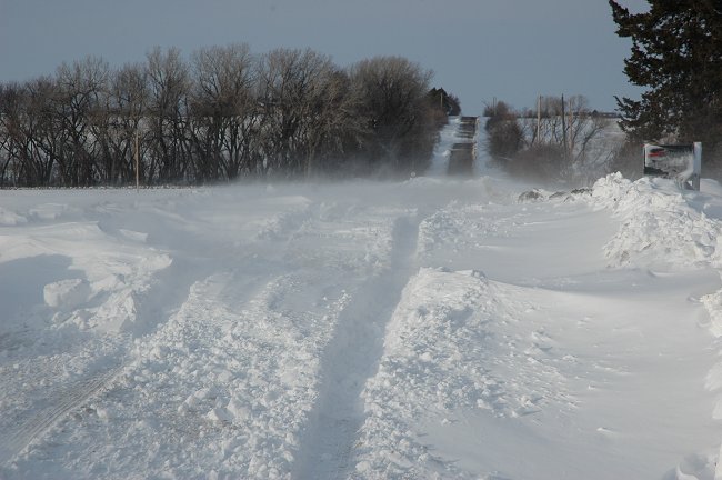
A rural Lancaster County road
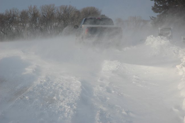
A rural Lancaster County road
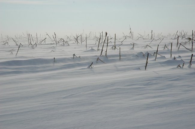
Rural Lancaster County
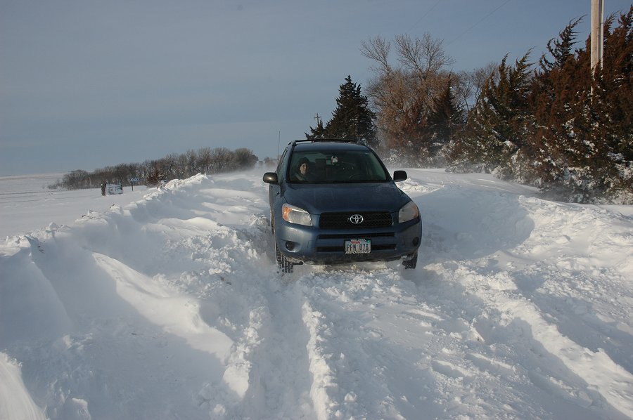
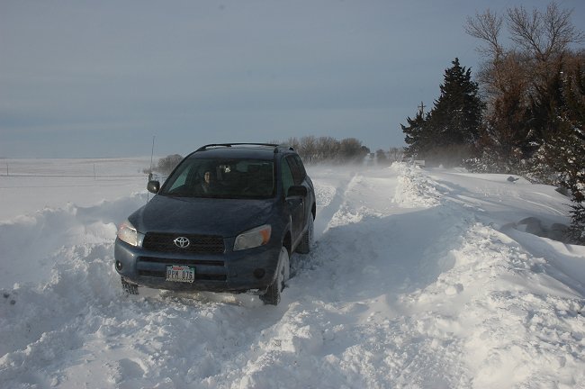
Stuck!
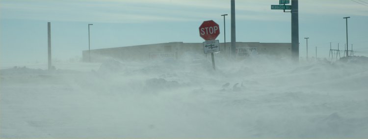
Blowing snow at Hwy 2 and 93rd
Street in Lincoln
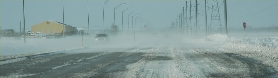
Blowing snow on 84th Street near
Adams St.
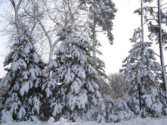
Photo: M. J. Melvin,
NDMC, Heavy Snow on the trees in Lincoln.
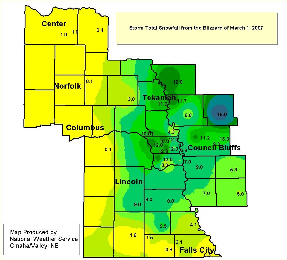
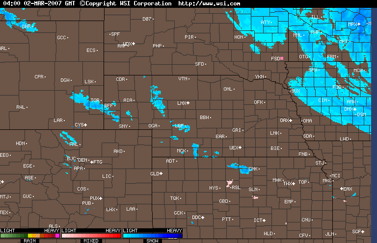
NWS Summary: Storm Total Snowfall from March 1 Blizzard
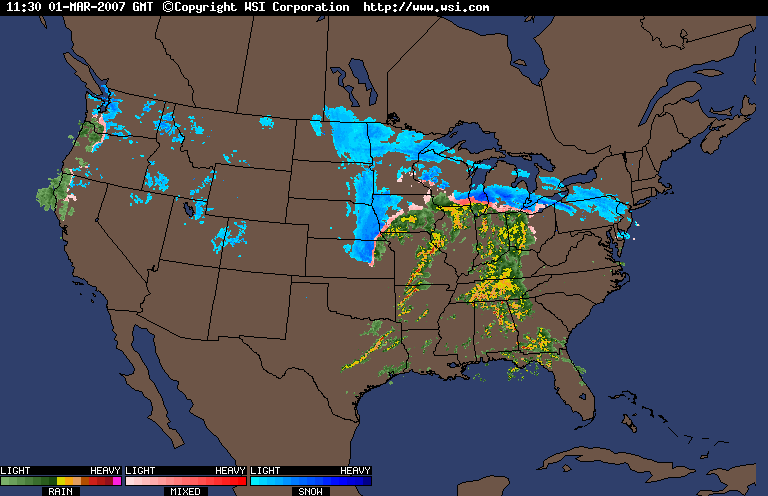
A DANGEROUS AND POWERFUL WINTER STORM HIT MUCH OF EASTERN NEBRASKA
AND SOUTHWEST IOWA DURING THE MORNING AND EARLY AFTERNOON HOURS
OF
THURSDAY, MARCH 1, 2007. THIS STORM BROUGHT HEAVY SNOW COMBINED
WITH VERY STRONG NORTHWEST WINDS TO CREATE WHITEOUT CONDITIONS AND
NEAR ZERO VISIBILITY. TRAVEL BECAME IMPOSSIBLE FOR MANY STRANDED
MOTORISTS, AND SEVERAL ROADS WERE CLOSED. THE STORM WAS ASSOCIATED
WITH AN UNUSUALLY DEEP LOW PRESSURE AREA. THE NATIONAL WEATHER
SERVICE IN VALLEY FIRST ISSUED A WINTER STORM WATCH FOR THIS EVENT
AT 4 PM ON TUESDAY, FEBRUARY 27TH, THEN ISSUED A BLIZZARD WARNING
AT
3:41 PM ON WEDNESDAY, FEBRUARY 28TH.
|
GRAND ISLAND Trace
AUBURN 0.5 inches
|
Return to: The Photo Gallery Index Page