 |
 |
 |
 |
 |
 |
|
|
|
|
|
|
|
|
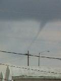
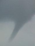
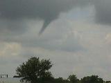
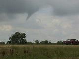
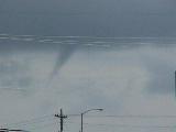
photo credits: Gary Banzaf and Darrel Kostman
| Storm Data Summary:
Event: Tornado Begin Date: 06 Jul 1998, 03:25:00 PM CST Begin Location: 5 Miles East of Cozad Begin LAT/LON: 40°52'N / 99°52'W End Date: 06 Jul 1998, 03:25:00 PM CST End Location: 5 Miles East South East of Cozad End LAT/LON: 40°52'N / 99°52'W Length: 1 Mile Width: 20 Yards Magnitude: F0 Fatalities: 0 Injuries: 0 Property Damage: $ 0.0 Crop Damage: $ 20.0K State: Nebraska Map of Counties County: Dawson Description:
|
Return to: The Photo Gallery Index Page