Rapid Convective Development
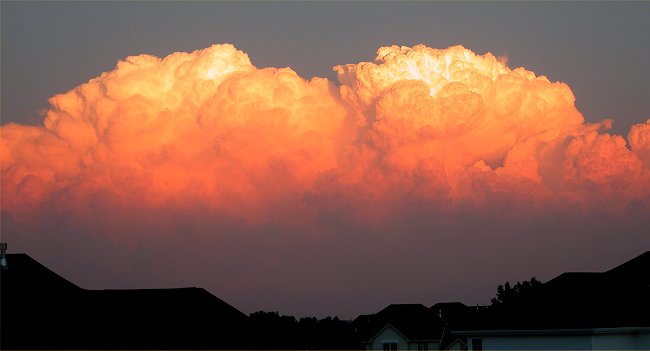
Supercell Thunderstorms Explode over southeast Nebraska
Images © K. Dewey, SNR, UNL
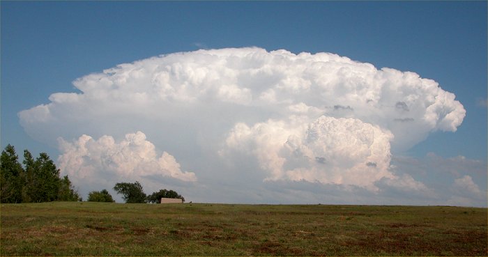
5:00 PM CDST, August 26, 2004. Looking
east from the southeast edge of Lincoln.
The thunderstorm is over Nebraska CIty, NE.
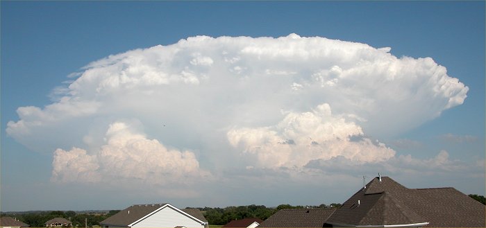
Looking
southeast from Lincoln Nebraska toward Nebraska City, NE
5:00 PM CDST, August 26, 2004. Looking east
from the southeast edge of Lincoln.
The thunderstorm is over Nebraska City, NE.
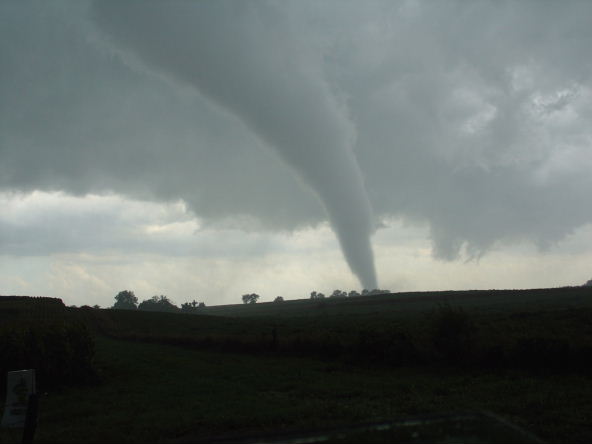
Image
© Jeremy Wesely, University of Nebraska: ~ 6:00 PM CDST,
August 26, 2004
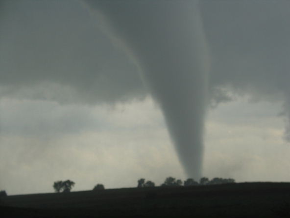
The
tornado was in rural Fremont county several miles east of Riverton
or
about 20 miles east of Nebraska City, NE. As this tornado decayed
an even larger wall cloud
formed
to it's east-southeast. This second wall cloud was rotating
extremely rapidly and moved almost
due
east along J64 from Riverton to Coin to Shambaugh (Just south of Clarinda).
It produced several brief
(on
the order of seconds) multi vortex tornadoes that would dance around
and then vanish.
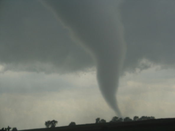
Image
© Jeremy Wesely, University of Nebraska: ~ 6:00 PM CDST,
August 26, 2004
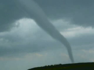
Image
© Jeremy Wesely, University of Nebraska: ~ 6:00 PM
CDST, August 26, 2004
Image
© Jeremy Wesely, University of Nebraska: ~ 6:00 PM
CDST, August 26, 2004
Image
© K. Dewey, High Plains Regional Climate Center
8:00 PM CDST, August 26, 2004. A secondary
line of thunderstorms begins to develop over SOutheast
Nebraska. Looking east from the southeast
edge of Lincoln.
Image
© K. Dewey, High Plains Regional Climate Center
8:05 PM CDST, August 26, 2004
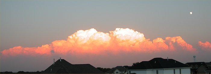
Image
© K. Dewey, SNR, UNL
8:15 PM CDST, August 26, 2004

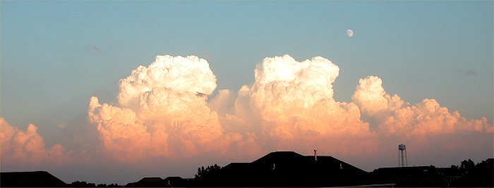
Image
© K. Dewey, SNR, UNL
8:20 PM CDST, August 26, 2004. Note
the moon rising over the storm clouds.
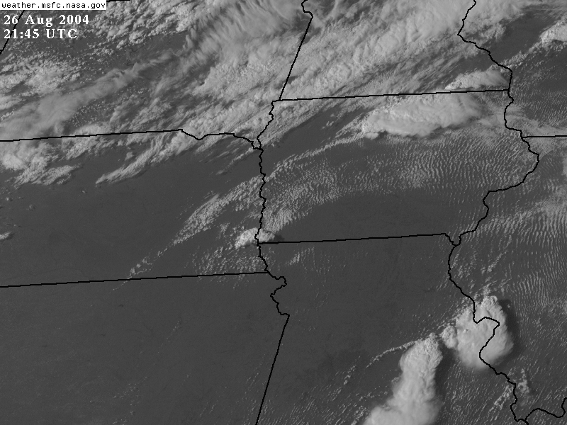
20:45 - 22:30 Z (3:45 PM - 5:30 PM CDST)
22:45 - 0:30 Z (5:45 PM - 7:30 PM CDST)
4:45 PM CDST
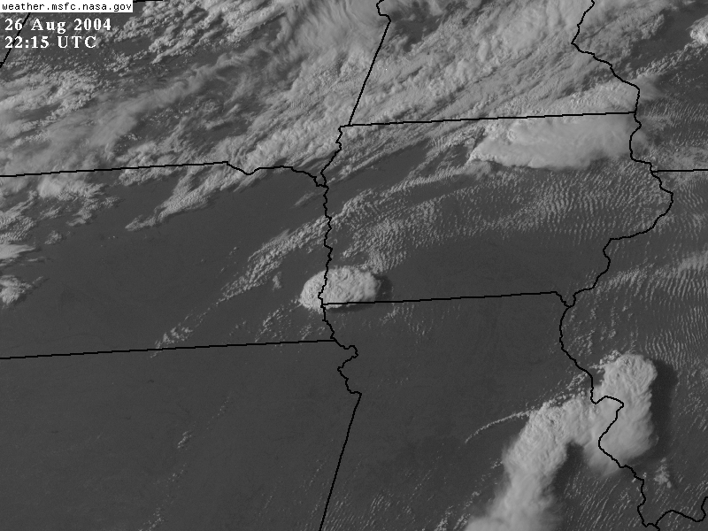
5:15 PM CDST
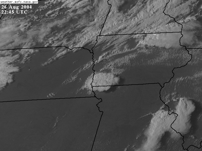
5:45 PM CDST
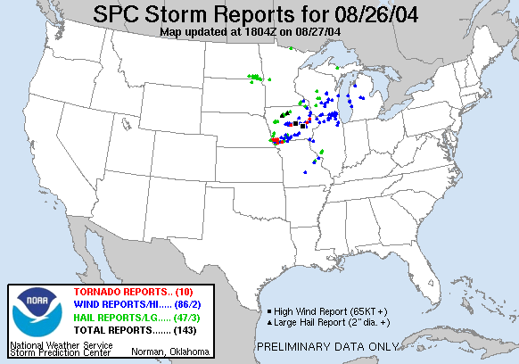
August
26, 2004 Tornado Reports
Source:Storm
Prediction Center