All photos (unless otherwise noted): ©Ken Dewey, UNL, SNR.
|
One of the most important atmospheric
measurements in the study of climate variation and climate change
is the measurement of atmospheric Carbon Dioxide (CO2)
at the Mauna Loa Observatory. This web site documents
a trip in December 2008 to the Mauna Loa Observatory to take
a look at this important observatory. The Mauna Loa
Observatory (MLO) is an atmospheric baseline station on
the Mauna Loa volcano, on the big island of Hawaii.
Charles David Keeling directed a program to measure the
concentrations of CO2 in the atmosphere that
continued without interruption from the late 1950's through
the present. This program, operated out of Scripps
Institution of Oceanography, is responsible for the Mauna
Loa record, which is almost certainly the best-known icon
illustrating the impact of humans on the planet as a whole.
The observatory is under the Climate Monitoring and
Diagnostics Laboratory, which is part of the National
Oceanic and Atmospheric Administration (NOAA). The
observatory consists of 10 buildings from which up to 250
different atmospheric parameters are measured by 12
NOAA/ESRL and other agency scientists and engineers. The
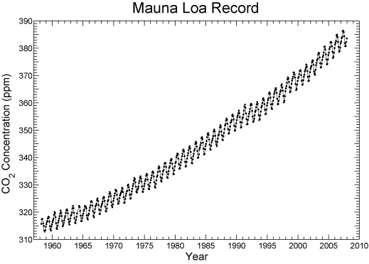
following graph, also known as the "Keeling Curve", is
probably the most often used illustration used to document
the human impact on our climate system. Mauna Loa was
originally chosen as a CO2 monitoring site
because, being isolated in the middle of the Pacific, the
air is exceptionally pure. Being high (11,135 feet), it is
above the inversion layer. There was also already a
convenient road to the summit built by the military. The air
purity is good as long as there is no contamination from
local volcanic sources, and when that is detected, the data
are removed.
Does it snow in Hawaii? The answer is at the bottom! CLICK here for live web cams from the Mauna Loa Observatory
|
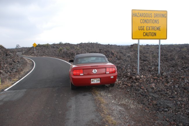
The entrance to the 17.6 mile long Mauna Loa Observatory road.
The lowest 5 miles of the access road to the observatory were paved in March and
April of 2007. This repair has made the lower portion road much more drivable,
although as evidenced here, the road is far from smooth and flat.
The entire access road is surrounded by lava flows from the Mauna Loa volcano with only sparse vegetation.
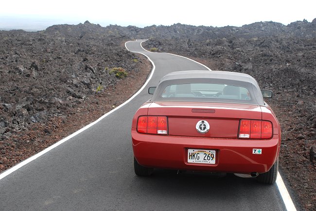
Fortunately, there is no traffic on this dangerous road since it is only used by the few
staff and researchers working at the observatory (and the infrequent visitor).
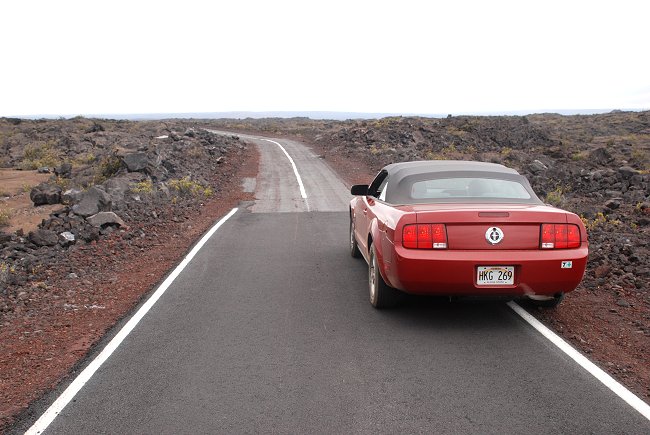
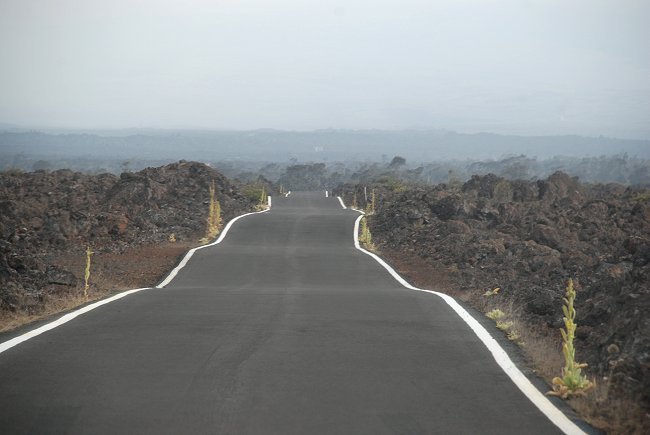
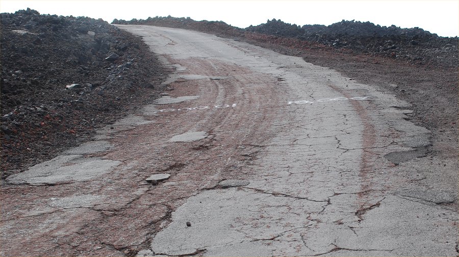
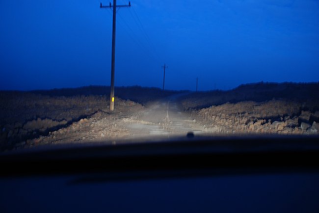
After 5 miles of smooth driving the road abruptly narrows and becomes much more primitive.
The access road is only a single lane wide, but it has a white line down the middle.
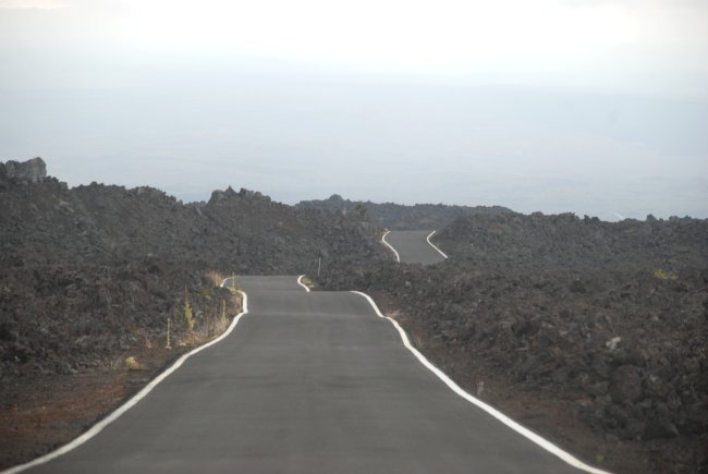
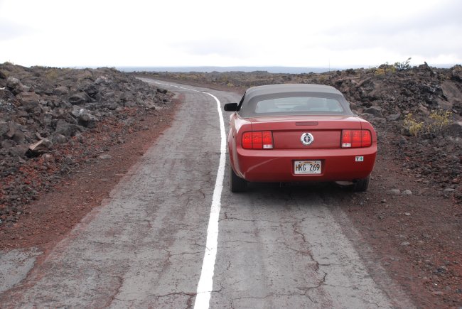
Midway along the road, the condition of the road continues to deteriorate
with large cracks and no shoulder.
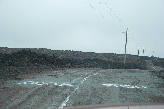
The elevation levels are spray painted across the road (here is the 9,000 foot level)
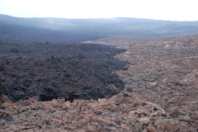
A more recent lava flow in black has spread across the older weathered lava.
Note the horrible condition of the road as we reach the 10,000 foot elevation level.
The road at this point has a 19% grade.
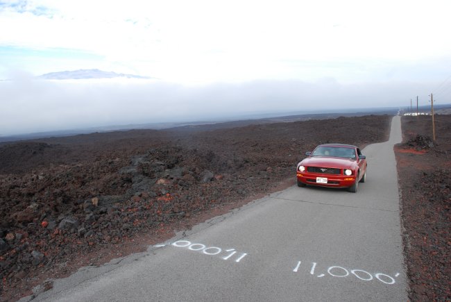
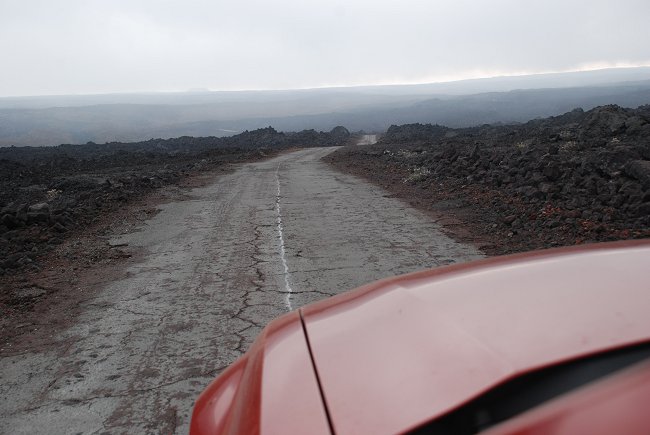
The last mile of the road is also recently paved as we cross the 11,000 foot level.
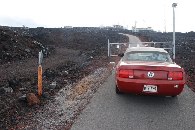
The Mauna Loa Observatory is a federal facility and gated. Any visits must be arranged well ahead of time.
Tours of the Mauna Loa Observatory mountain facility are available on selected weekdays. To schedule
a tour, contact station chief John Barnes by email or phone (808-933-6965 x222). Please try to make your request
a few weeks in advance. Please note also that Mauna Loa Observatory is not an astronomy observatory.
For those interested in astronomy, and the Mauna Kea Observatory see http://www.ifa.hawaii.edu/info/vis/
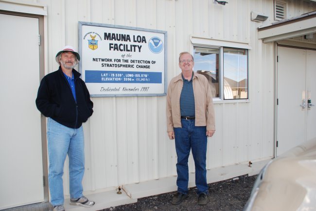
At the entrance to the research facility main building, also known as the Keeling building.
On the left is The Mauna Loa Observatory station chief, John Barnes,
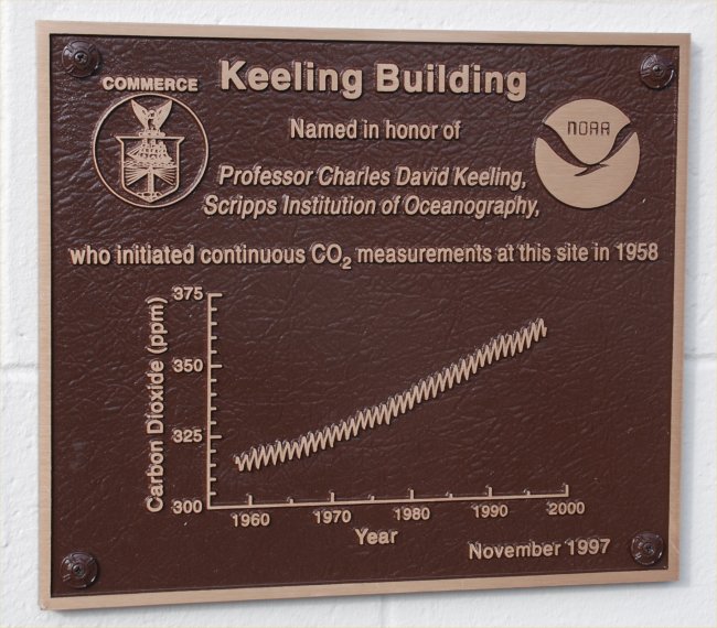
A commemorative plaque at the Observatory.
In addition to the measurement of CO2, numerous other research projects are conducted at this site.
LINK to the listing of research projects at this Observatory.
LINK to a map of the facility showing the various projects.
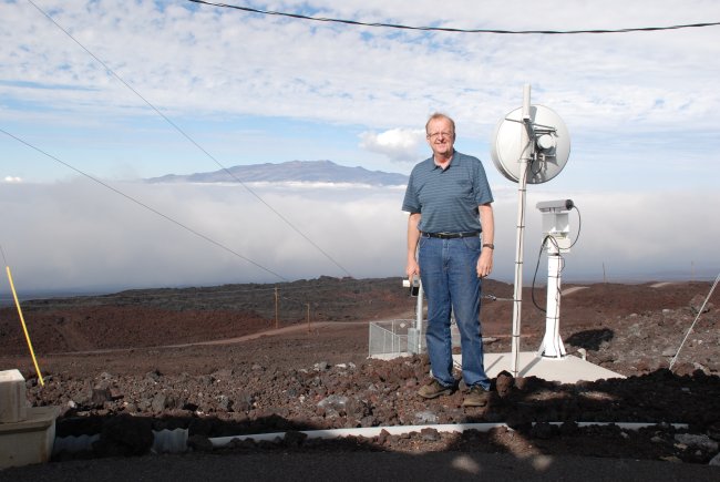
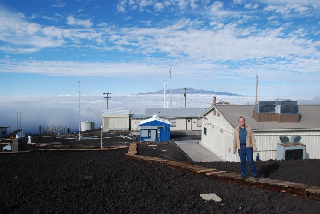
The facility is above the clouds at the time of this photo. The mountain peak in the distance is
Mauna Kea, the other large volcano on the island. The road leading up to the observatory can be
seen behind me and heading down to the right into the clouds.
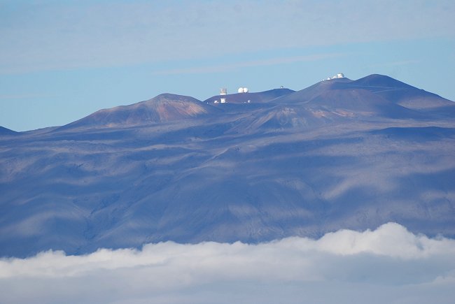
Using a telephoto lens, Mauna Kea observatory can be seen in the distance.
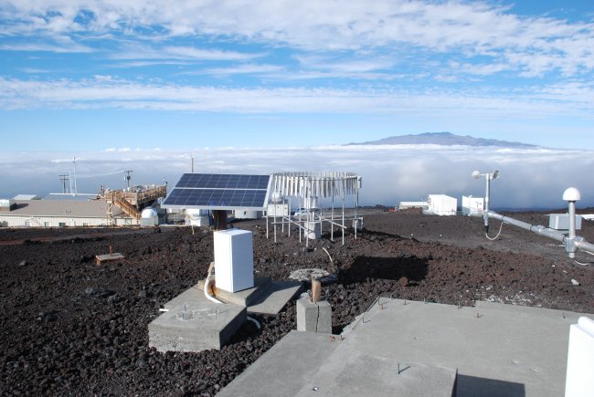
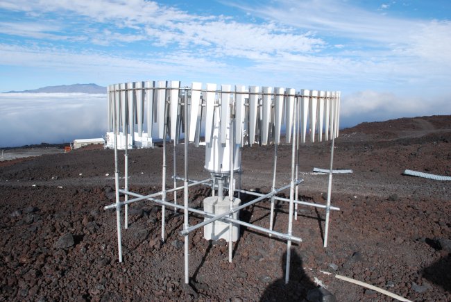
An array of various instruments at the Observatory.
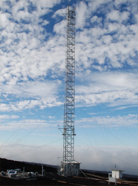
This is tower used for the instruments used to measure Carbon Dioxide at the observatory.
This is a shielded rain gauge collecting basic climate data as part of the Climate Reference Data Network
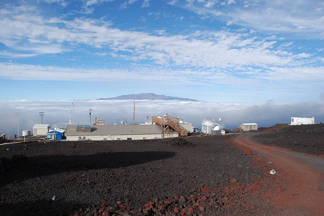
A view looking down at the entire Observatory.
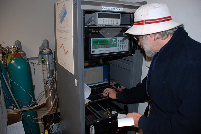
Checking on the Carbon Dioxide measurements at the observatory.
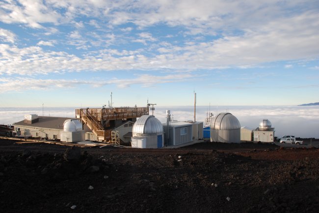
Another view looking down at the entire Observatory
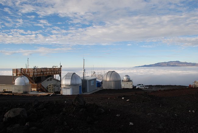
Another view of the Observatory with a view of Mauna Kea in the distance past the cloud covered valley.
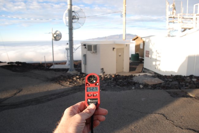
Although the air temperatures down at sea level were typically near 80 F in the afternoon,
the air temperature at the observatory barely made it into the 50's (here 52.7 F at 4 PM).
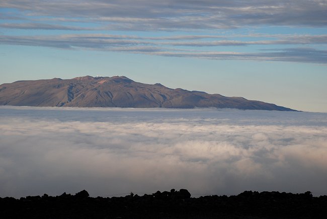
Just before sunset, looking across the valley from the Observatory toward Mauna Kea.
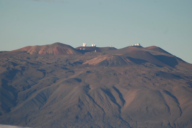
A close up view of the Mauna Kea Astronomy Observatory.
The trip back down the volcano on the observatory access road is especially dangerous after dark
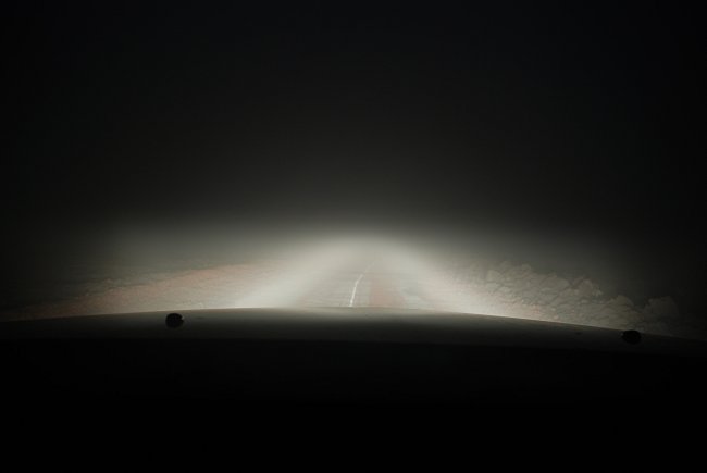
and, even more dangerous as the road descends into the clouds.
Does it snow in Hawaii? Yes.
Below here is an image from January 2005 with an explanation below the image.
|
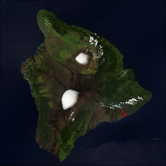
On the high peaks of Hawaii’s Mauna Loa (south) and Mauna Kea (north) a cap of brilliant white snow covered the summits on January 14, 2005, when this image was captured by the Moderate Resolution Imaging Spectroradiometer (MODIS) on NASA’s Aqua satellite. The third volcano that makes up the island is Kilauea, where ever-present lava flows give off a heat signature detectable by MODIS (area outlined in red). Charcoal streaks of cooled and hardened lava reach down the brown flanks of the volcanoes toward the ring of lush forests that climb the lower slopes. Image courtesy the MODIS Rapid Response Team, NASA-GSFC |
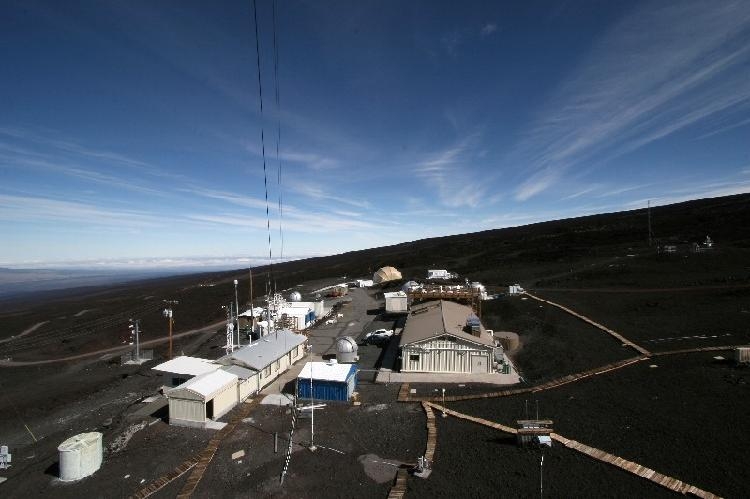
An elevated view of the Mauna Loa Observatory (provided by NOAA).