Lake Mead at Hoover Dam
October 2006
All Images © Ken Dewey, HPRCC, NDMC
Thank you
Mark Briggs of Brown and Caldwell
(Environmental Engineers and consultants) for taking us out on a boat photo
tour of
Lake Mead. Brown and Caldwell delivers leading edge engineering and
business solutions to efficiently and effectively meet
the environmental
needs of public agencies, government and private industry.
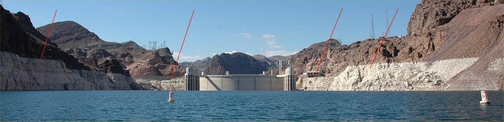
Approaching Hoover Dam on Lake
Mead. The four red lines point to the
normal level of Lake Mead.
Note that the water level is
well below spillway on the right. The three
red lines point to the normal level of Lake Mead.
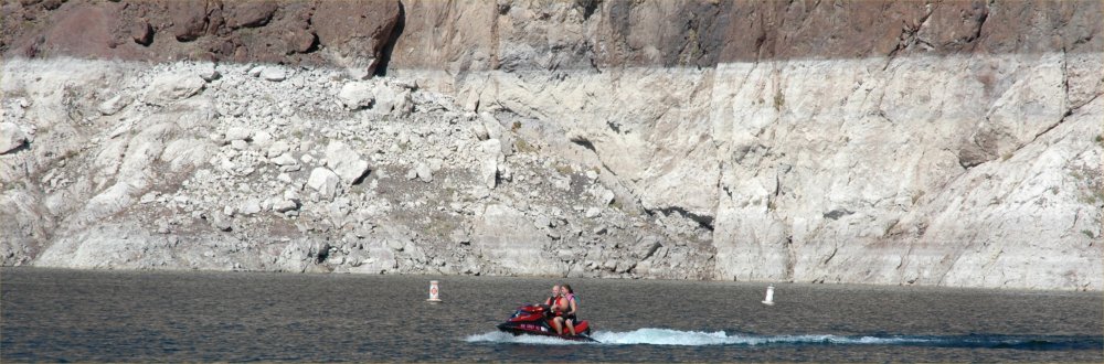
A jet ski on Lake Mead near Hoover
Dam
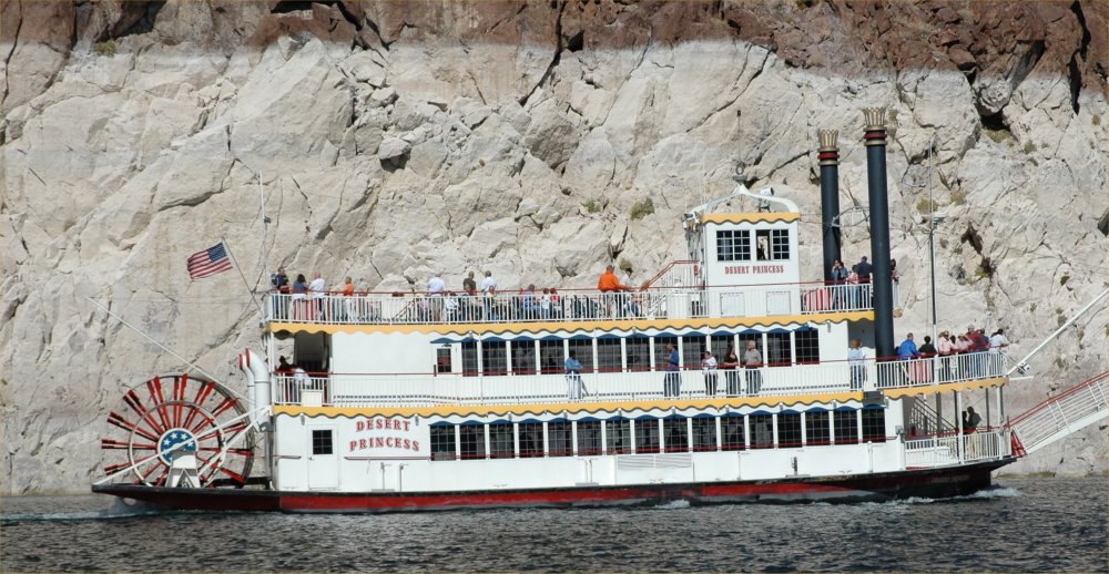
The "Desert Princess" is well
below the water line (white "bathtub ring") of the normal water level of
Lake Mead
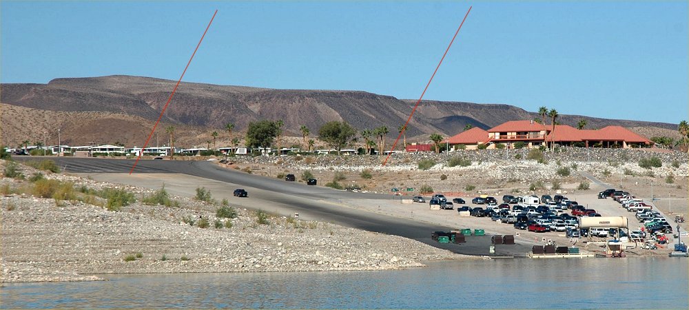
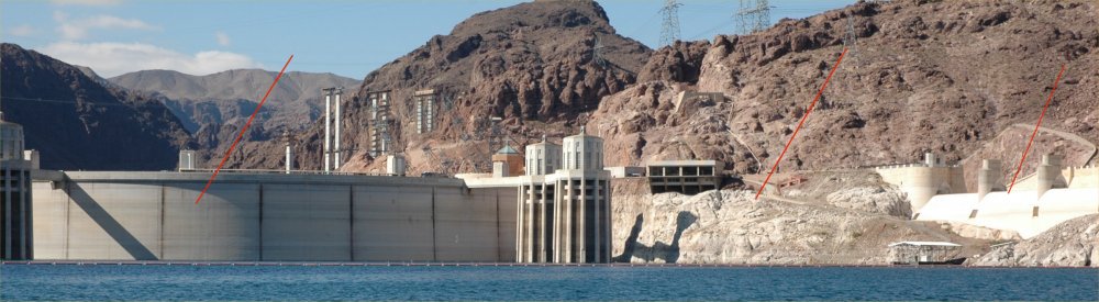
The three
red lines indicate the normal level of the
lake. The boat ramp has been extended several times to keep up with
the receding shoreline.
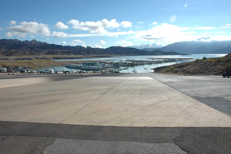
Another
view of the boat ramp which has been extended several times to keep up
with the receding shoreline.
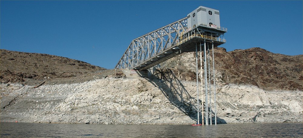
The old
intake and raw water supply to BMI (which processed magnesium in Henderson
during WWII).
There is
a small red boat at the bottom of the intake system providing scale for
how much the water level has fallen.
The two
red lines indicate the normal level of the
lake.
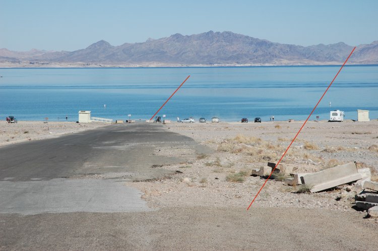
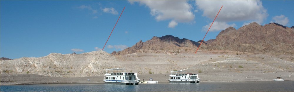
One of
the beaches in Lake Mead National Park. The two
red lines indicate the shoreline
at capacity
and the current shoreline now that the lake has dropped almost 90 feet
since 1998.
The newer
asphalt road was added as the lake level dropped and the shoreline receded.